Leapfrog and Micromine
Export supported drilling, terrain, and map data for use in your mining-software workspace.
Prepare the package in Mineflow
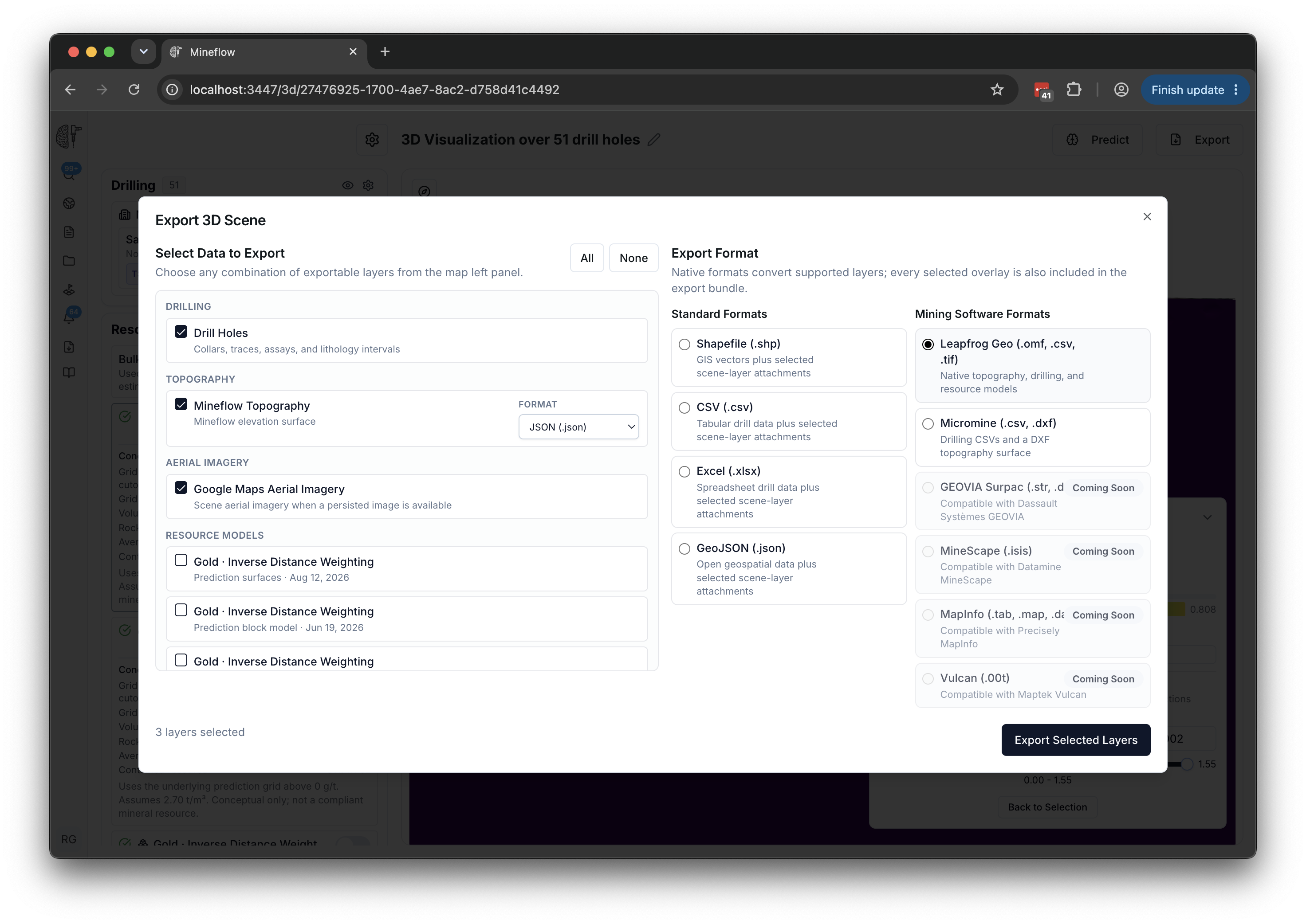
- Open the relevant 3D scene or supported map export and select Export.
- Select the drilling, terrain, and other available layers you need.
- Choose Leapfrog Geo or Micromine.
- Download the completed package from Exports and extract the ZIP before importing its contents.
Open a Leapfrog package
A drilling package can include drillholes.omf, collar and survey CSVs, available interval tables, source attribution, and coordinate information. Included files depend on your selection.
- Read README.txt and the coordinate reference information in the extracted package.
- In Leapfrog Geo, open the application menu and choose OMF → Import.
- Select drillholes.omf and review the available objects.
- Check collar positions, elevations, hole geometry, and the expected interval attributes against the Mineflow view.
Use the CSV tables when you need a table-based drilling import. Map hole identifiers and interval fields consistently. Keep geology and recovery information separate from assay grades.
Menu details and format support vary by Leapfrog version. See Seequent's OMF import guide for the application workflow.
Open a Micromine package
Micromine packages provide drilling CSVs and a DXF terrain surface when selected and available. The drilling tables preserve separate collar, survey, assay, geology, recovery, and downhole geophysics content where present.
| File | Import as |
|---|---|
| collar.csv | Collar table: hole identifier, easting, northing, elevation, and maximum depth. |
| survey.csv | Downhole survey: hole identifier, depth, dip, and azimuth. |
| assay.csv | Assay interval table: hole identifier, From, To, and the desired grade columns. |
| geology.csv / recovery.csv / geophysics.csv | Separate interval or measurement tables when those files are included. |
| surfaces/topography_surface.dxf | DXF wireframe or terrain surface when topography was selected. |
Read the package instructions for the exact field names and coordinate system. In Micromine, use the appropriate table and CAD import tools for those files. The Micromine import guide describes the available import families.
Check coordinates before combining data
- Match the package's coordinate reference system, datum, and units to the destination project.
- Compare a known collar or reference point before importing the rest of a large dataset.
- Check elevations, dip conventions, assay units, and interval depths.
- Keep the original archive and source attribution so an imported value can be traced back.
If a layer does not line up, check coordinate settings first. Do not move it by eye to force a fit; send Mineflow the export reference and an example location if you need help.