Georeferencing
Turn maps inside exploration reports into geographic layers you can compare, investigate, and take into your next stage of work.
Put historical mapping back into context
Years of exploration evidence can be locked inside report pages: geological plans, magnetic survey maps, prospect layouts, and interpreted structures. Mineflow can extract supported map images and place them in their geographic location, so you can work with the information alongside other data.
That turns a map you would otherwise inspect on its own into a layer you can compare directly with drillholes, satellite imagery, tenements, and newer surveys.
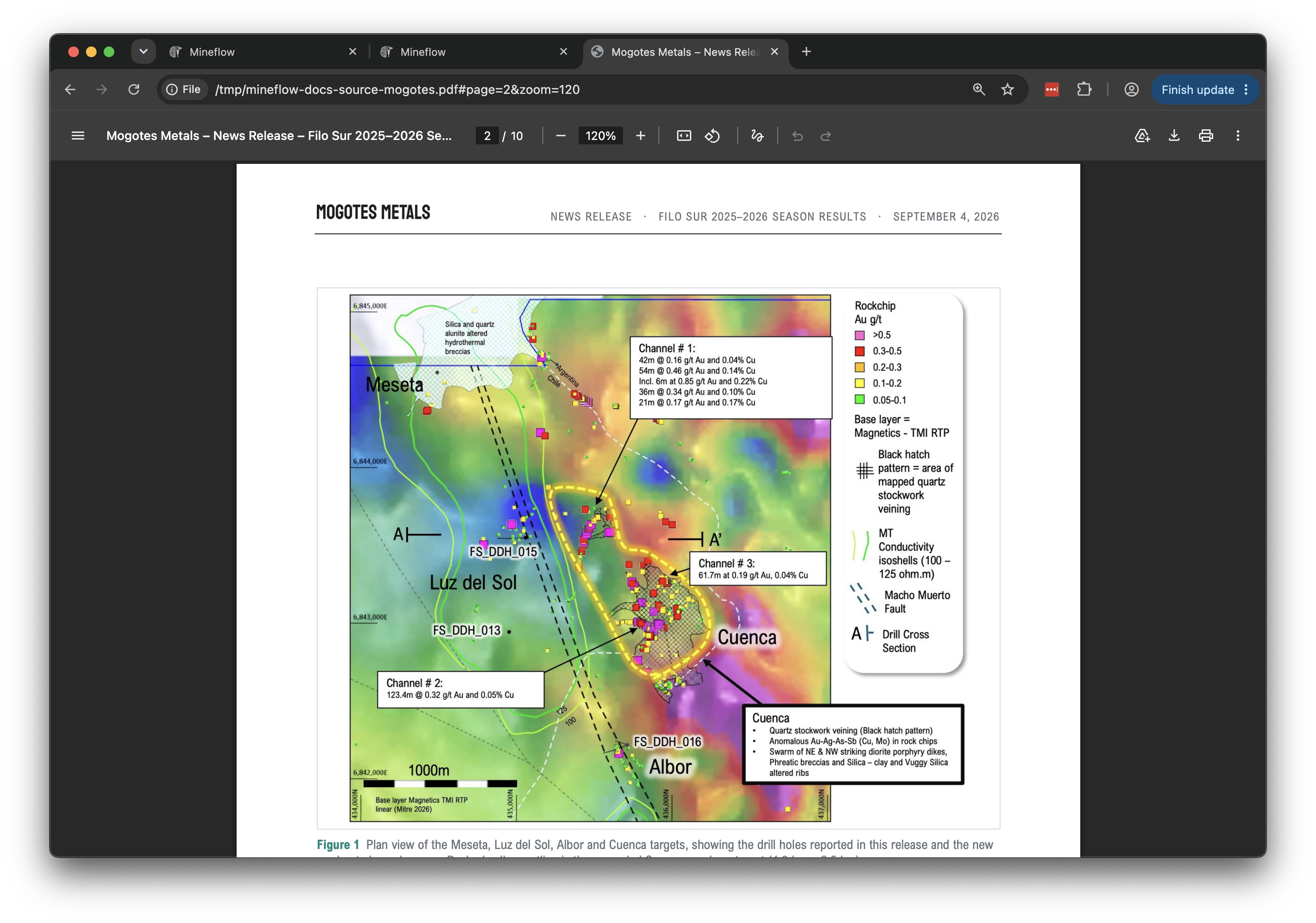
How Mineflow places the map
- Find the map. Mineflow identifies map content within a supported document or image.
- Read the geographic evidence. Coordinate labels, grid markings, projection information, and other available map evidence help establish where it belongs.
- Check the placement. Geographic reference points and the resulting image transformation are checked for consistency before a georeferenced output is accepted.
- Make it usable. The output becomes a geographic image layer, with a connection back to the source and a GeoTIFF download where available.
The benefit is practical: you can investigate a historical map without first transcribing its contents or manually positioning every supported image.
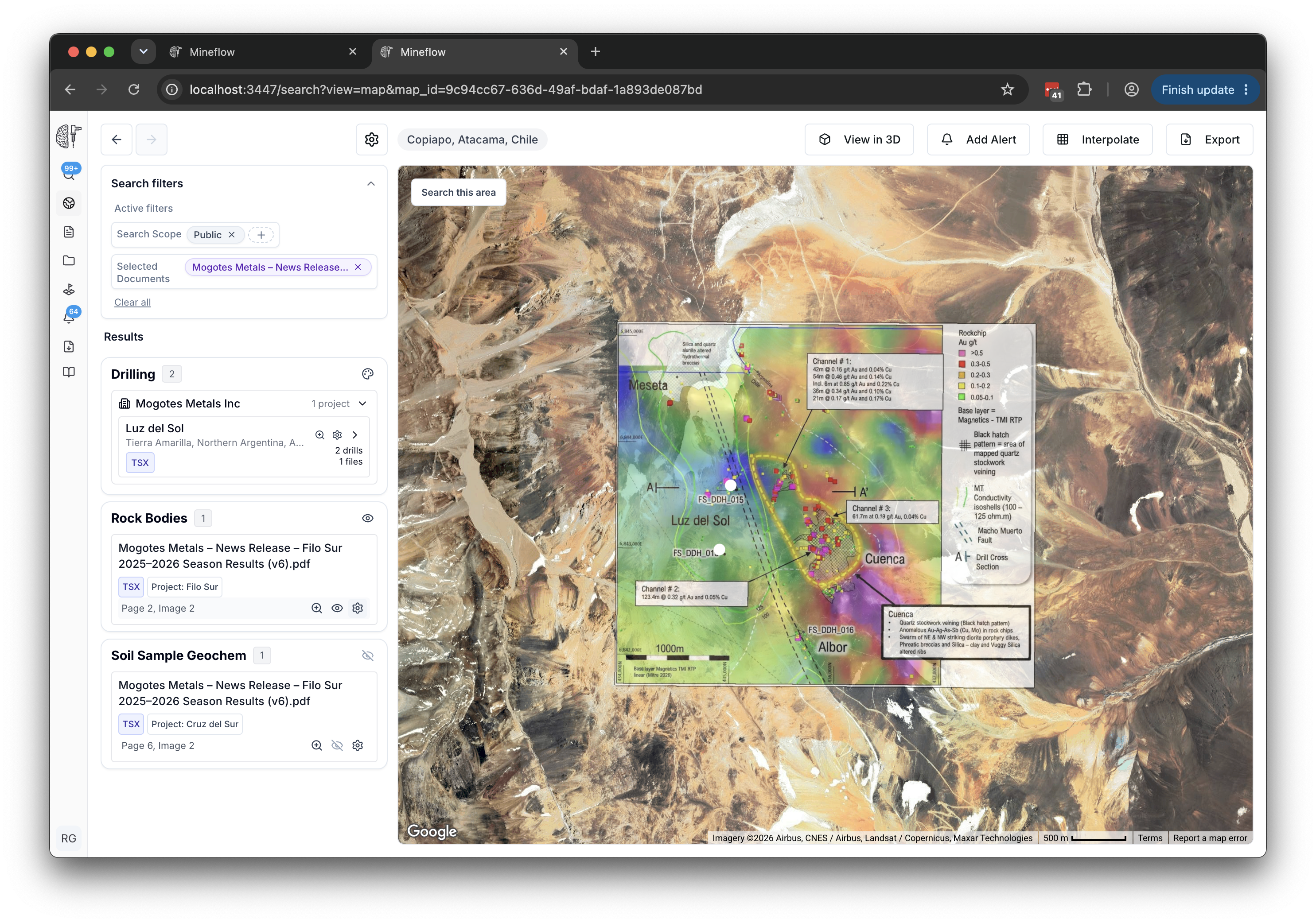
Use the result in an exploration workflow
- Compare mapped geology or survey patterns with current drill coverage.
- Bring several campaigns into one view and inspect where their footprints overlap.
- Check a historical interpretation against surface samples or newer imagery.
- Download an available georeferenced TIF for further work in a GIS or a compatible mining application.
To try it, upload a supported map or report, accept the processing quote when shown, wait for processing, and open the extracted layer from Files or a map result. The sample library includes an aeromagnetic map of Kepenkeck Lake. You can also open the sample PDF.
Map figures within a report are quoted separately from the report's text, tables and linked drilling. A standalone map image has its own georeferencing rate. Unchanged curated samples are free to process; see File processing charges for the rates and included work.
Check the source and alignment
Readable coordinate marks and complete projection information improve the available evidence. Cropped labels, scan distortion, local grids, and small map scales can limit the result. Some figures, including many cross sections and diagrams, are not plan-view maps that can be placed this way.
Before relying on the alignment, compare recognizable reference points and check the original map's scale, datum, and coordinate reference system. The quality of a georeferenced overlay remains limited by its source.