Australian Tenements
Review public Australian tenure snapshots, track status changes, and send selected licences straight to the map.
Overview
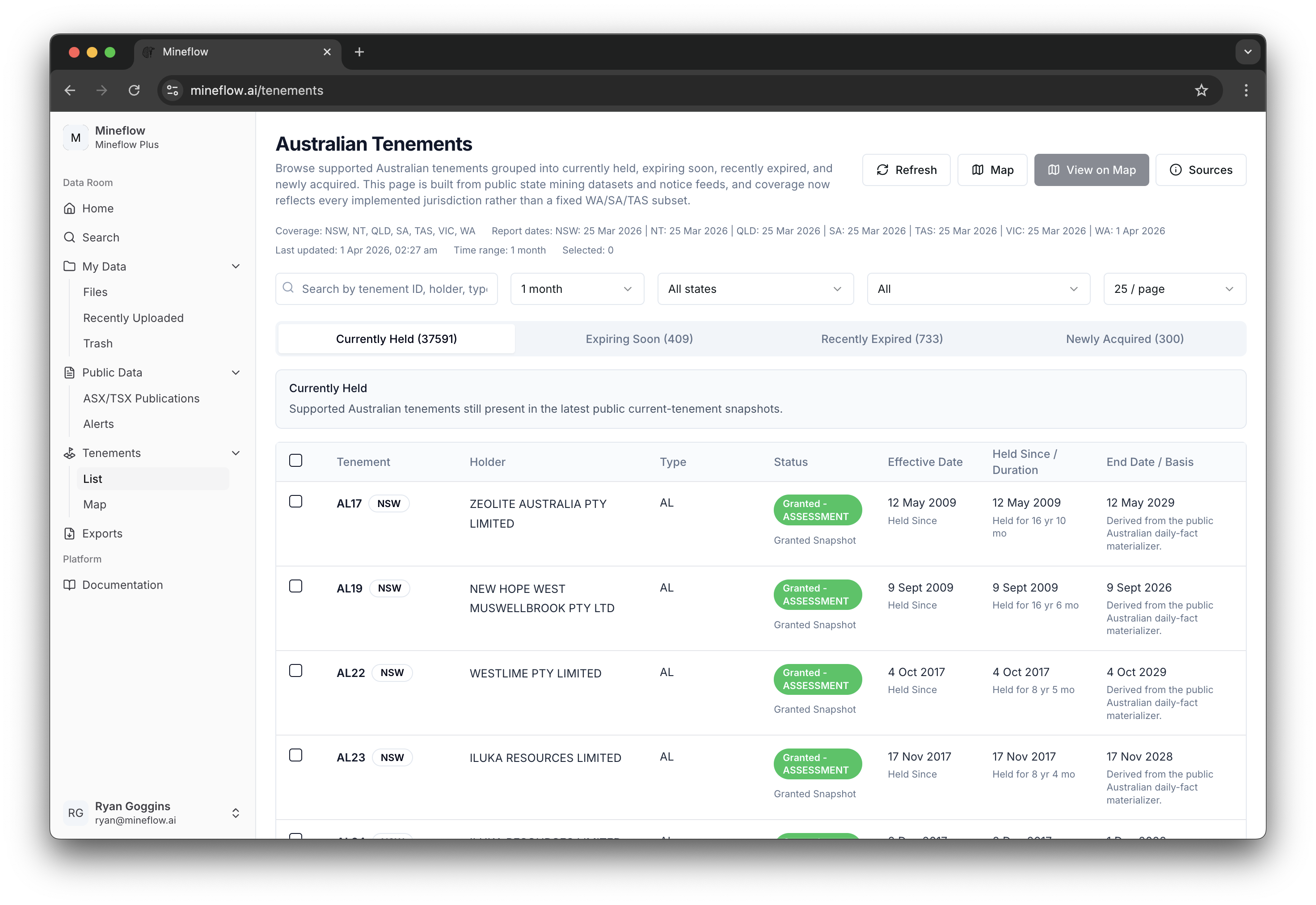
The /tenements page materializes Australian public tenure into one searchable table. It combines currently held, expiring, recently expired, and newly acquired records from the latest public state mining datasets and keeps enough metadata in the table to understand why each row appears.
Snapshot Coverage and Filters
The header summarizes which states and report dates are represented in the current materialized view. Use the filters directly beneath it to narrow by identifier, holder, time window, state, and source slice before you send anything to the map.
- Coverage tells you which jurisdictions are currently represented in the public feed.
- Report dates explain the recency of each jurisdiction snapshot.
- Time range controls how far back Mineflow should look for status changes such as expiring soon or recently expired.
- Selected tracks how many tenure rows are checked for row-scoped map actions.
Status tabs
The four tabs split the public feed into Currently Held, Expiring Soon, Recently Expired, and Newly Acquired so you can review tenure change as a workflow instead of as one undifferentiated table.
Table columns
Each row includes the tenure identifier, holder, type, current status label, effective date, held-since duration, and the end date or legal basis explaining why the row appears in the chosen tab.
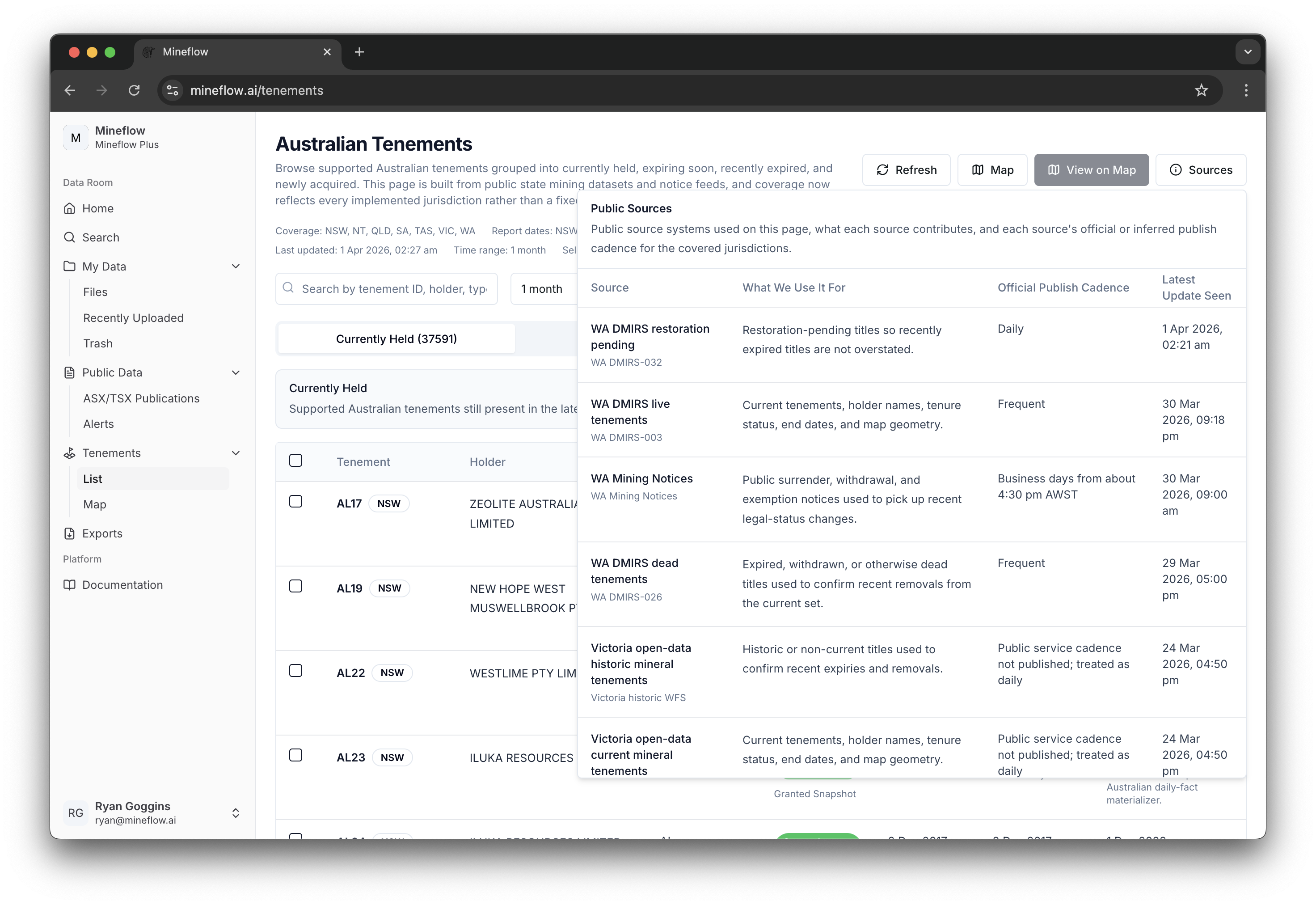
Source Transparency
The Sources button exposes the jurisdiction-level provenance behind the current table. Use it when you need to verify which public system a state feed came from or when the recency of a snapshot matters for an outreach or land analysis workflow.
Map Actions
The top-right actions split into full-view and selection-scoped map handoffs.
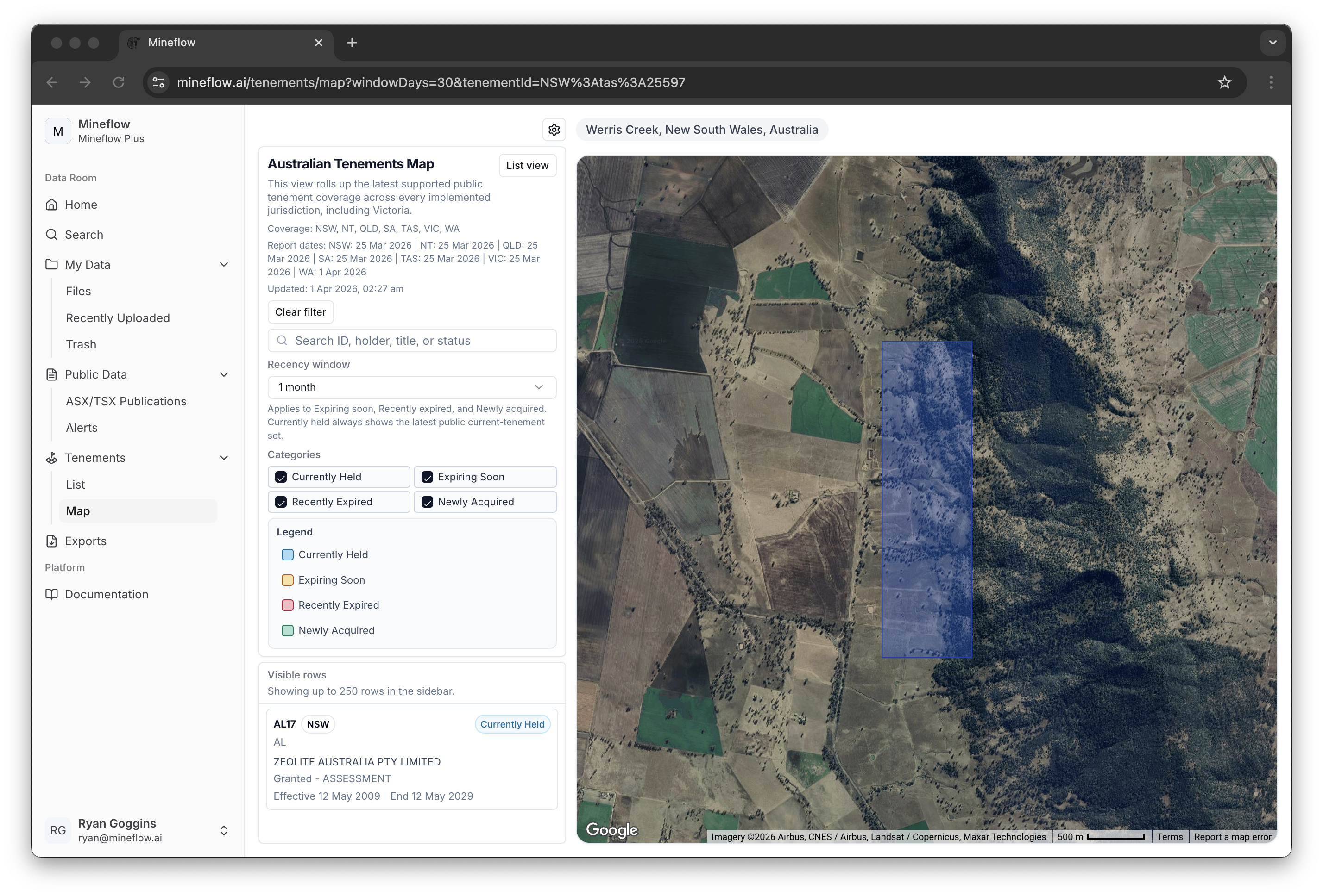
Map
Opens the broader tenements map for the currently filtered dataset, even if no individual row is selected.
View on Map
Uses the checked rows as the map scope and zooms to the selected tenure polygons.
Refresh
Re-runs the table query against the latest available public materialization without changing your current filter state.