Data Processing
Automatic Data Processing
In other geological software programs, you need to specify which columns of your tables are collars, which ones are geological properties, which ones are assays, etc. In those other programs, you would need to manually transcribe the tables out of PDFs and then manually join them together. Mineflow does all of this automatically.
Why This Matters
On our site, you can upload your Google Drive Folder or Dropbox and Mineflow will find every single drill hole you have ever logged, where it was logged, and what the data was that you collected from that hole. Then, you can view it on a map, or view it in 3D, look at cross sections etc.
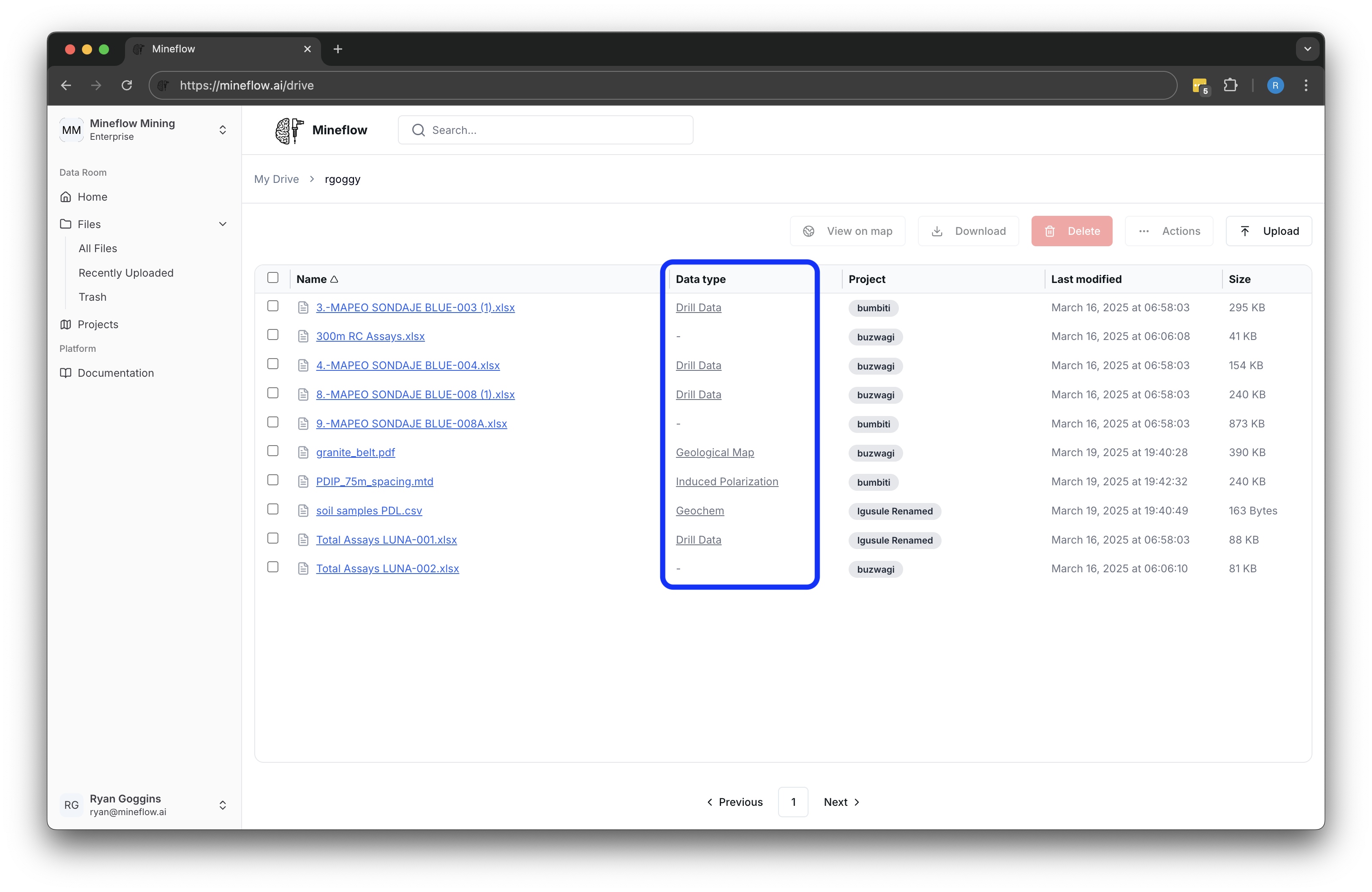
Here's an example of how this works with drill data. After giving Mineflow my Google Drive folder, it shows me all of the files in the folder and specifies what type of data it pulled out of each of them:

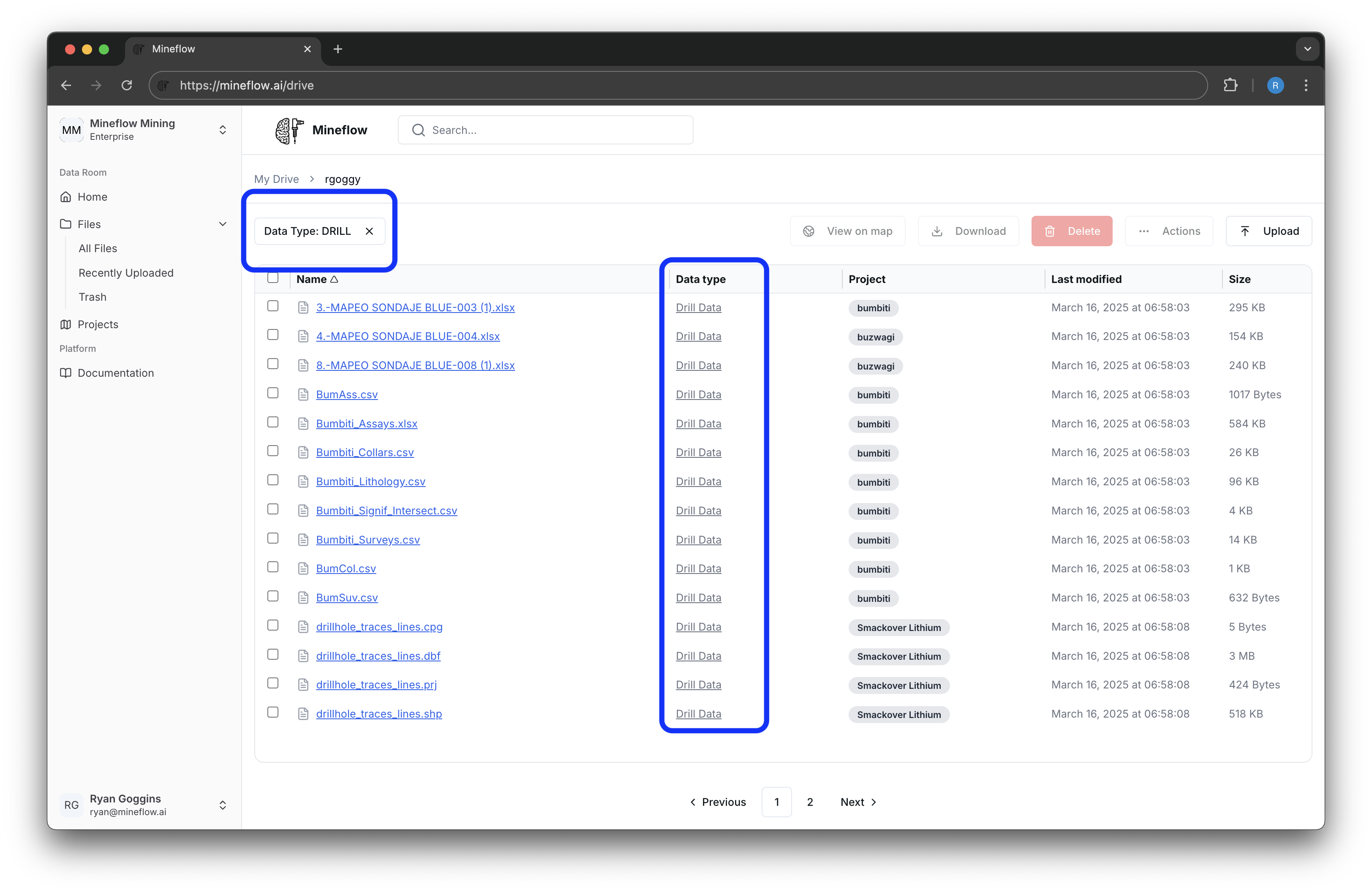
If you click on a data type (e.g. Drill Data, Geological Maps, Geophysical Surveys), you can filter your entire dataset to find all of the files of that type (e.g. all magnetic surveys you have run in an area).

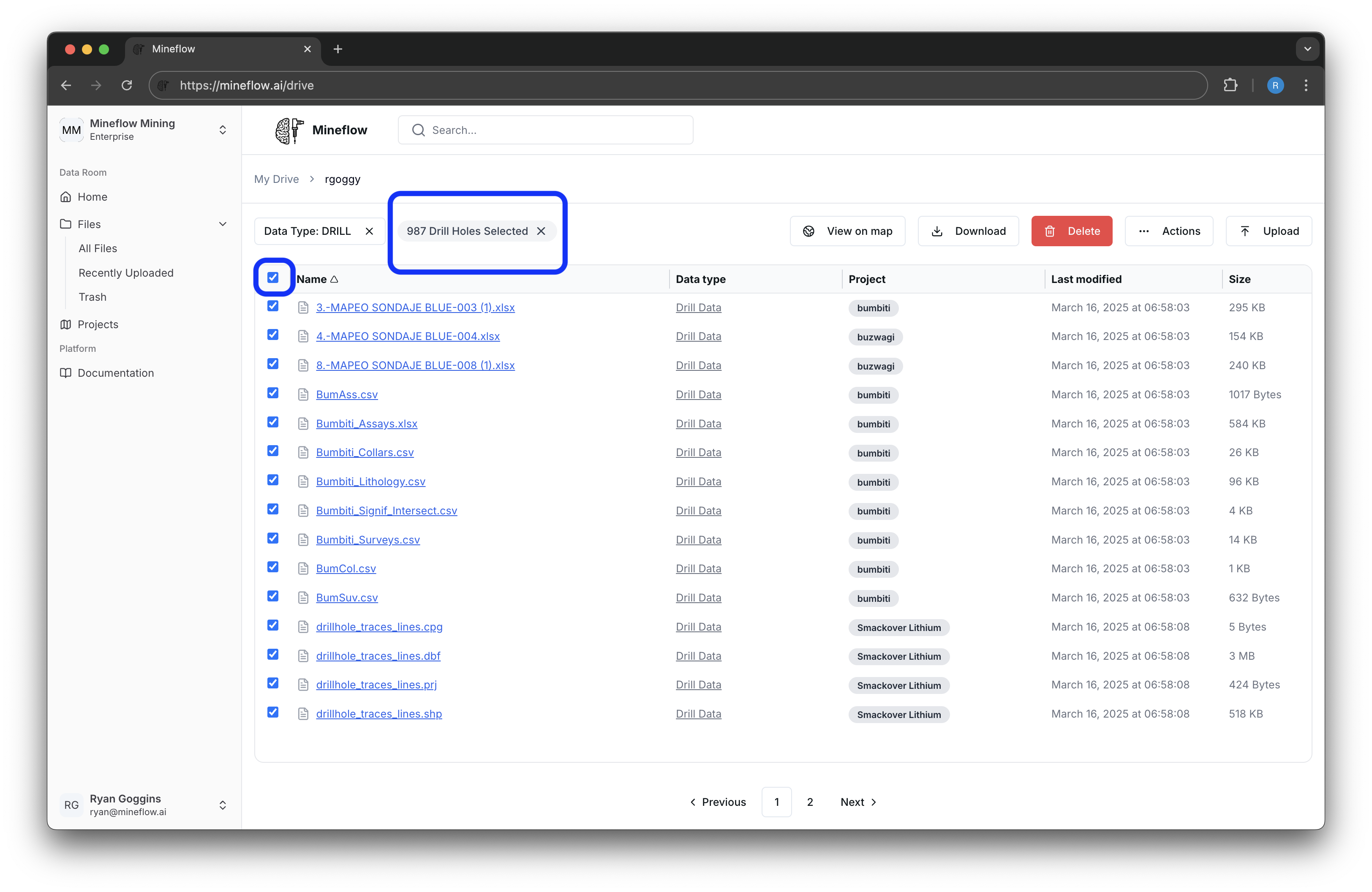
By selecting those files, you can see how many unique drill holes are in those files and easily view them on a map.

We will soon extend this to allow the user to see all of the data types in their entire portfolio on a map, not just drill data.
