Exclusion Zone Tracking

Add land-access, heritage, native-title, and protected-area context to a drill-hole or survey map before advancing an exploration area.

Australia Is Available Now

Mineflow currently publishes 19 Australian reference overlays in five categories. They can be added to an existing map search without replacing the drill, survey, or tenure results already on the map.

Australia · Available now

National layers are combined with more detailed Western Australian land-access and cultural-heritage sources.

Canada · Future coverage

Canadian exclusion-zone coverage is planned for the future. It is not currently available in this control and will be added as authoritative federal and provincial sources are validated for publication.

Choose the Reference Overlays

  1. Open a public or saved map search, then select Search Result Settings from the map settings button.
  2. Find Land access and heritage. Expand a category to review its individual published layers and source dates.
  3. Turn on a complete category or select individual layers. Close the dialog to inspect the enabled context on the map and in the results panel.
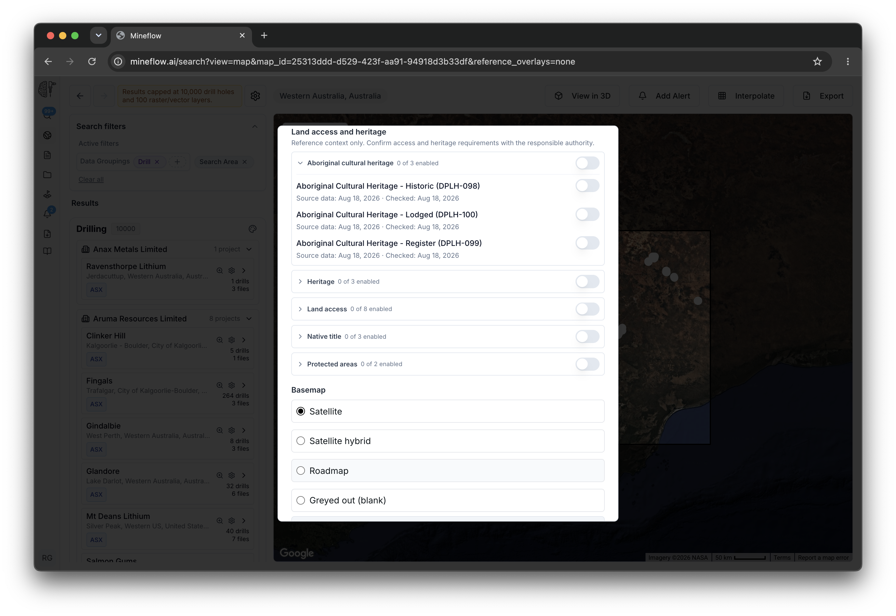
Search Result Settings showing five Australian land-access and heritage reference-overlay categories.
All five Australian categories are published. A count such as “0 of 3 enabled” means none of that category's layers are selected for this map; it does not mean the data is unavailable.
Expanded Aboriginal cultural heritage category showing individual published layers and source dates.
Expand a category to choose exact layers and check when each publisher dataset was dated and when Mineflow last checked it.

Australian Coverage

The current catalog mixes Australia-wide sources with detailed Western Australian sources. It should not be read as a complete legal-constraint inventory for every Australian state and territory.

CategoryPublished layersCurrent scope
Aboriginal cultural heritage3Western Australia
Heritage3Australian national, Commonwealth, and World Heritage context
Land access8Western Australia
Native title3Australia-wide determinations, claims, and agreements
Protected areas2Australia-wide CAPAD coverage plus Western Australian DBCA land
Total19Published Australian reference overlays

Read the Map Results

Search-area intersections

When a search area exists, the left panel limits enabled overlay results to features intersecting that area.

Source and recency

Each layer shows publisher attribution, source-data date, Mineflow check date, and links to its source and licence.

Feature details

Select a mapped feature to review available publisher fields, access implications, and any boundary caveats.

Use Country Monitoring for cadastre context, or continue to Tenement Watchlists to monitor exact mineral titles over time.